Following a highly intense period of weather activity in the Pacific Northwest, the atmospheric pattern along the West Coast is now shifting its focus toward California, providing a welcome respite for the hard-hit regions farther north.
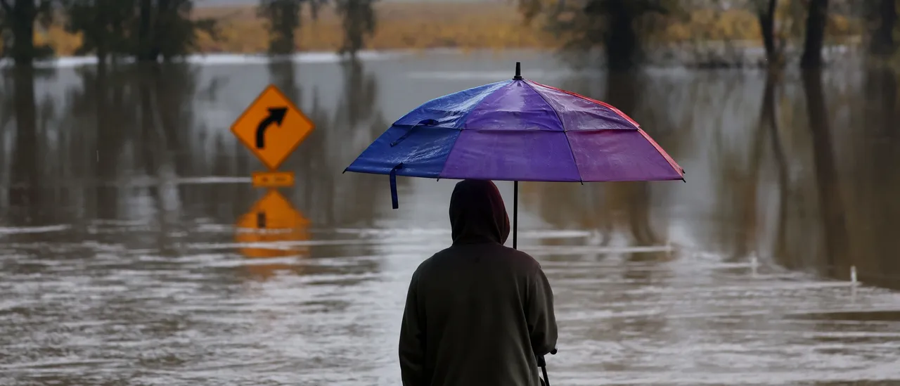
Multiple waves of rain, snow and winds are expected to impact California beginning Sunday, heightening the risk of flash flooding — initially in parts of Northern California and continuing throughout the remainder of the week, according to the FOX Forecast Center.
California is bracing for three separate episodes of precipitation, which are likely to disrupt travel across the state. Major airports such as Los Angeles International, San Francisco International and Sacramento International could face delays and complications, while ground transportation will also be affected, creating challenges for drivers on key routes including I-5, I-10, I-15, I-40 and Highway 101. (RELATED: Can You Expect White Christmas? Here’s Weather Outlook For Jesus’ Birthday)
The storm sequence kicks off Sunday when the upcoming atmospheric river drifts southward, aligning directly over Northern California. Meanwhile, a powerful low-pressure system tracks into the Gulf of Alaska, and ridging over Southern California helps channel moisture from Hawaii — creating a textbook Pineapple Express event.
Certain locations may receive an entire month’s rainfall total, whereas others could accumulate the bulk of their annual average precipitation in only a handful of days.
ANOTHER ROUND ☔️: Yet another atmospheric river is set to target the Northwest, eyeing Central and Northern California through early next week, increasing the concern for flash flooding and mountain snow during the busy holiday travel week. pic.twitter.com/dSb2dy6Vgg
— FOX Weather (@foxweather) December 20, 2025
As this influx of moisture targets the California coastline directly, extensive rainfall is anticipated across much of Northern California beginning Sunday. The potential for flash flooding is particularly high in areas from the Napa Valley northward to Chico, with a current Moderate risk (Level 3 out of 4) for flash flooding in place across Northern California and the foothills of the northern Sierra Nevada.
Farther south, a Slight risk (Level 2 out of 4) encompasses key urban centers such as San Francisco and Sacramento. Flood watches are already in effect for much of Northern California, extending through at least Friday.
Broad rainfall amounts ranging from 3 to 5 inches are anticipated throughout Northern California, including the coastal areas. Greater accumulations are projected for the foothills of the northern Sierra Nevada, with 5 to 8 inches likely and isolated spots potentially seeing as much as 10 inches by Tuesday. While debris flows remain a notable concern in areas affected by recent wildfires, more extensive river flooding is expected, particularly along the California coastline.
The snow-deprived Sierra Nevada is poised to receive significant snowfall at last, paving the way for ski resorts to flourish during the season. Coastal effects are also anticipated from Tuesday through Wednesday, including potential wind gusts reaching up to 80 mph.
I’M DREAMING OF A … ATMOSPHERIC RIVER CHRISTMAS?
Starting Tuesday night and continuing into Wednesday, a second wave of heavy flooding rainfall and intense winds will push onshore across Northern California. The system is forecast to strengthen as it progresses inland, delivering wind gusts reaching up to 80 mph along the coast and raising the risk of additional flooding, per the FOX Forecast Center.
Certain weather models suggest that this storm system could potentially develop into a bomb cyclone as it nears the coast early Wednesday morning. The risk of flash flooding continues across much of Northern California with further rounds of heavy rainfall affecting the area. The National Weather Service (NWS) office in San Francisco has urged both residents and visitors to avoid the Pacific coastline as the storm approaches.
During this second storm phase, the moisture will also extend southward. Rainfall is projected to progress along the coast, affecting Central and Southern California through Christmas Eve and into Christmas Day, which will substantially disrupt holiday travel on the I-5 corridor. Present forecasts indicate 3 to 5 inches of accumulation across the Los Angeles metropolitan region. (RELATED: South Dakota, Wyoming See Evacuations Due To Wildfires Erupting From Hurricane-Force Winds)
Should Los Angeles accumulate more than 3.82 inches of rain, it would establish the record for the wettest Christmas Eve and Christmas Day two-day span on record. One final surge of moisture is forecast to sweep across the state from late Thursday into the weekend, and with soils already thoroughly soaked after almost a week of rainfall, the potential for flash flooding will be considerably heightened.
There’s a positive aspect for the elevations: snow levels are forecast to lower to the elevations of major mountain passes (around 5,000 to 6,000 feet) as Christmas Eve nears. Although this will create significant disruptions for travel, it offers essential replenishment for the Sierra Nevada, where snowpack remains far below normal — northern areas are currently at only 5% of typical levels, with southern sections near 40%. Substantial snowfall is also anticipated in parts of the Rockies as the moisture spreads toward the Intermountain West.


![Donald Trump Slams Chicago Leaders After Train Attack Leaves Woman Critically Burned [WATCH]](https://www.right2024.com/wp-content/uploads/2025/11/Trump-Torches-Powell-at-Investment-Forum-Presses-Scott-Bessent-to-350x250.jpg)

![CNN's Kaitlan Collins Fact-Checks Rep. Jasmine Crockett Over False Trump Ballroom Claim [WATCH]](https://www.right2024.com/wp-content/uploads/2025/10/1761954330_CNNs-Kaitlan-Collins-Fact-Checks-Rep-Jasmine-Crockett-Over-False-Trump-350x250.jpg)