From Wednesday into the weekend, locations from Texas to Illinois will be a target of multiple waves of severe weather, which will feature risks of tornadoes, hurricane-force winds, flooding and hail.
The majority of thunderstorms will form across the edge dividing amplifying warm and humid air out of the Gulf of America and crispier air pushing southward from Canada. The center focus will be along areas of the Mississippi Valley and Great Plains.
Wednesday will see the first round of severe weather, which will take place in northeastern and central Texas upwards through central and southern Missouri, southeastern Kansas and southern Illinois. (RELATED: Train Of Storms To Bring Heavy Rainfall, Flash Flooding Concerns To Drought-Stricken Mississippi Valley)
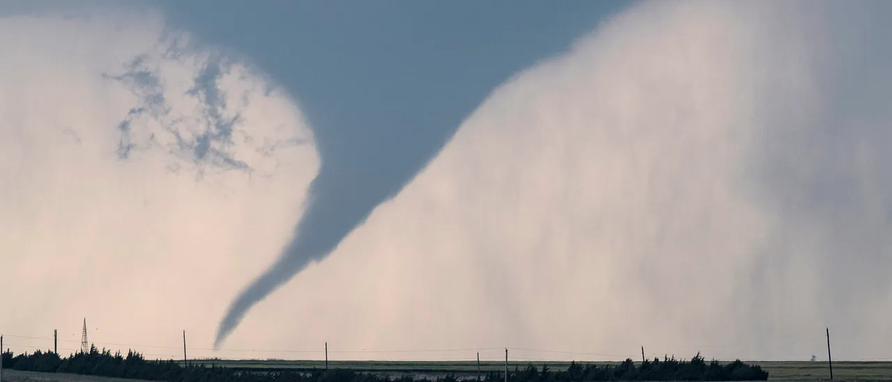
The biggest threats of the severe weather will be huge hail and hurricane-force gusts, with AccuWeather‘s Local StormMax registering at 80 mph. Tornadoes could also be generated from some of the most intense storms.
When we get to Thursday, the atmosphere will be reloaded across zones in the same area. In the evening and throughout the night, the risk of severe weather will expand from central and northwestern Texas through central and western Oklahoma, as well as south-central Kansas.
Isolated tornadoes, flooding, hail, damaging wind – it’s all in the forecast this week from the Texas hill country through much of the Plains and into the Ohio Valley. pic.twitter.com/rqmEx6uIEc
— AccuWeather (@accuweather) March 2, 2026
Thursday night, the tornado risk appears to be low, however, the heftiest storms will be capable of producing hail and strong gusts.
The threat of severe weather will shift east Friday, widening from central Texas towards southwestern and central Missouri. The potential for multiple tornadoes will be present along with hail and gusts.
More waves of severe weather will take place along a portion of the same location, and in zones further south and east, into the weekend. (RELATED: Rural Nevada Shook By Magnitude 4.3 Earthquake)
In every round, the risk of severe weather could persist throughout the night, elevating the situation — particularly if tornadoes form after the sun goes down.
Overall, the weather pattern will heighten the flooding threat. A lot of the rainfall could be advantageous going into the growing season following drought conditions for months, however, isolated zones could experience a large amount of rainfall too rapidly, enlarging the urban flooding threat and risk of small stream flash flooding.


![CNN's Kaitlan Collins Fact-Checks Rep. Jasmine Crockett Over False Trump Ballroom Claim [WATCH]](https://www.right2024.com/wp-content/uploads/2025/10/1761954330_CNNs-Kaitlan-Collins-Fact-Checks-Rep-Jasmine-Crockett-Over-False-Trump-350x250.jpg)


![Kamala Comes Unglued, Makes Bogus Claim About Her Landslide Loss to Trump [WATCH]](https://www.right2024.com/wp-content/uploads/2025/10/Kamala-Comes-Unglued-Makes-Bogus-Claim-About-Her-Landslide-Loss-350x250.jpg)