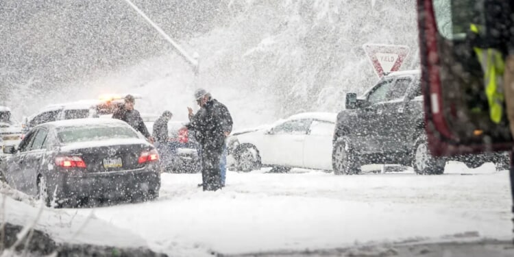
Another round of winter weather is approaching the United States, set to affect at least 25 states with the possibility of snow showers extending as far south as Tennessee and North Carolina.
Initial forecasts called for a potent clipper system moving Tuesday toward the Great Lakes to spark a complicated winter storm, delivering heavy snowfall across much of the East.
However, a pulse of warmer air is expected to arrive ahead of the system, converting most of the precipitation to rain rather than snow. The rain will then shift eastward toward the coast by Wednesday.
As the quick-moving clipper pushes farther south, the trailing cold front will take over as the main force organizing the rain and snow.
Although this adjusted pattern reduces the odds of a major snowstorm, widespread impacts are still anticipated. Portions of the Ohio Valley, for example, could pick up some light snow showers. (RELATED: Atmospheric River Setting Up Fresh Flooding Risk For Pacific Northwest, Which Has Already Been Blasted By Heavy Rain)
Farther to the east, the arrival of colder air and the amount of leftover moisture will determine whether isolated snow showers develop, though significant accumulation remains unlikely given the milder, wetter conditions in advance of the system.
Any short-lived snow bursts could lead to abrupt travel disruptions, particularly if visibility decreases rapidly.
Areas across the Interstate 95 corridor are forecast to experience only minor effects.
Once the system progresses eastward, the incoming colder air will promote lake-effect and lake-enhanced snow close to the Great Lakes, as well as upslope snow in the Appalachian region.
WINTER STORM HQ ❄️: A strong clipper system moving through the Canadian provinces will swing across the Great Lakes, bringing primarily rain at first, followed by colder air that will fuel intense snow showers. It sets the stage for the next winter storm across the Eastern U.S. pic.twitter.com/eoyFNj1caM
— FOX Weather (@foxweather) January 12, 2026
The western shoreline of Lake Michigan, stretching from Michigan toward the Indiana-Illinois state line, stands to see the most significant impacts — especially if winds shift from southerly to northerly.
According to the FOX Forecast Center, snow is expected to develop from late Wednesday into Thursday, with moderate to heavy accumulations ranging from 8-12 inches possible in favored zones.
Additional lake-effect and lake-enhanced snowfall will target areas near Lake Superior around Marquette, along with Lake Erie, Lake Ontario, northern Pennsylvania and parts of Upstate New York.
Uncertainty lingers regarding the exact wind direction — whether it settles more northerly or northwesterly — which could shift the bands of heaviest snow to different locations.
The weather system will begin influencing the Appalachians late Wednesday, primarily targeting higher elevations. (RELATED: Disaster Declarations Issued In Alaska As Incoming Atmospheric River Could Cause Flooding, Avalanches)
With northwest winds in place, snow showers are likely to intensify through early Thursday. Upslope snowfall will focus on elevated terrain from the Tennessee-North Carolina border northward through West Virginia and across the tallest ridges of the Appalachians.
The FOX Forecast Center indicates that locations west of the mountains may receive light snow, while those east of the range could see only scattered light rain showers.
Currently, widespread heavy snow appears improbable outside the highest elevations, where temperatures will remain too warm to support large accumulations.
The bulk of accumulating snow is projected to occur from early Wednesday into Thursday morning, gradually tapering off to occasional flurries by Thursday afternoon.


![Donald Trump Slams Chicago Leaders After Train Attack Leaves Woman Critically Burned [WATCH]](https://www.right2024.com/wp-content/uploads/2025/11/Trump-Torches-Powell-at-Investment-Forum-Presses-Scott-Bessent-to-350x250.jpg)


