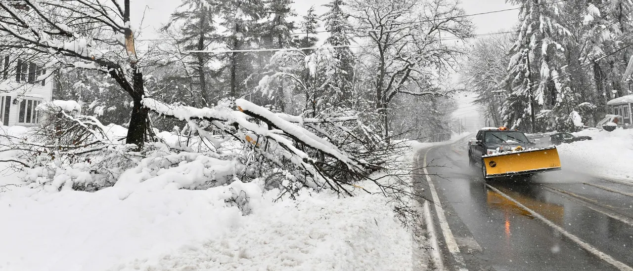
National Weather Service (NWS) forecasters warn that a powerful winter storm will hammer a lot of the Northeast U.S. with heavy snowfall — over a foot in some locations — beginning Monday night and lasting into Tuesday.
The system is also expected to deliver a treacherous mix of snow and ice across a wide swath from northeastern Oklahoma eastward into the Ohio Valley, leading to especially dangerous road conditions. (RELATED: Jamaica’s Economy To Suffer 11-13% Shrink In Q4 2025 After Record-Setting Hurricane Melissa)
The National Weather Service forecasts at least six inches of snow by Tuesday night through portions of New York, New Jersey, Massachusetts, Vermont, New Hampshire and Maine.
It’s being predicted by the NWS that the heaviest snowfall will be from the Poconos into Downeast Maine, with five to 10 inches expected between Monday night and Tuesday night. Areas of higher elevation could witness accumulations exceeding a foot.
A winter storm will approach the Mid Atlantic and Northeast beginning Monday evening with a threat of snow and ice across the interior portions of both regions. Any snowfall and ice will present hazardous travel concerns, especially across the interior Northeast U.S. pic.twitter.com/ihA8xWyyS2
— NWS Weather Prediction Center (@NWSWPC) November 30, 2025
Starting Monday morning, freezing rain may lead to ice accumulation in parts of Oklahoma and Arkansas, with the highest risk of significant icing being through the central and southern Appalachians.
From southwestern North Carolina into western Virginia and through western Maryland, a quarter-inch of ice accumulation is possible from Monday night into Tuesday morning, according to the National Weather Service.


![Donald Trump Slams Chicago Leaders After Train Attack Leaves Woman Critically Burned [WATCH]](https://www.right2024.com/wp-content/uploads/2025/11/Trump-Torches-Powell-at-Investment-Forum-Presses-Scott-Bessent-to-350x250.jpg)
![Kamala Comes Unglued, Makes Bogus Claim About Her Landslide Loss to Trump [WATCH]](https://www.right2024.com/wp-content/uploads/2025/10/Kamala-Comes-Unglued-Makes-Bogus-Claim-About-Her-Landslide-Loss-350x250.jpg)
![Two Dead, 14 Injured After Gunfire Erupts Following College Football Game in Alabama [WATCH]](https://www.right2024.com/wp-content/uploads/2025/10/Two-Dead-14-Injured-After-Gunfire-Erupts-Following-College-Football-350x250.jpg)