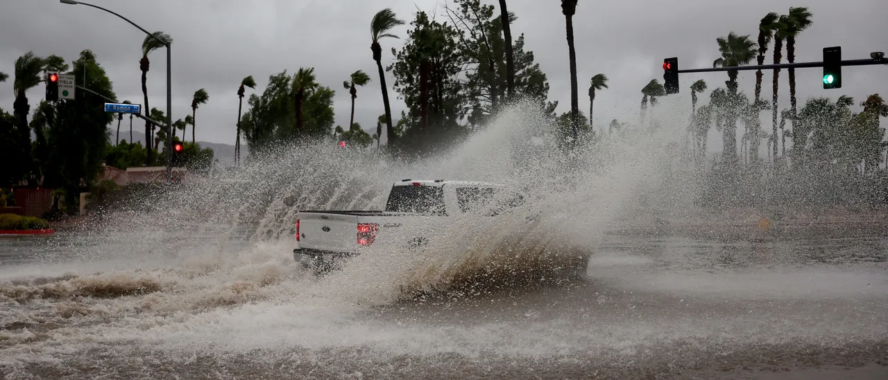
Hurricane Priscilla is currently a high-tier Category 2, with the storm recording maximum sustained winds of 110 mph Tuesday as it heads north right off the coast of Mexico.
Although the system is forecasted to weaken over the next few days beginning Wednesday, the Southwest United States will need to keep an eye on developments as both California and Arizona have been placed into Priscilla’s cone of uncertainty, which is the end of a hurricane forecast cone on graphics that are widened due to uncertainty from forecasters. (RELATED: Tropical Storm Jerry Forms In Atlantic, Expected To Become Hurricane Within Days)
According to the National Hurricane Center (NHC), a surge of moisture from Priscilla is expected to cause heavy rainfall across the Southwest United States in the coming days. As the hurricane weakens while on its track, it’s expected that it will interact with another storm that will be from the Pacific Northwest, and this will bring subtropical moisture from Priscilla far inland throughout the West.
Here are the 2pm MST Oct 7th Key Messages for #Hurricane #Priscilla:
Latest info at https://t.co/Oy8uoeSibM pic.twitter.com/Kv6oq3ZyT4
— NHC Pacific (@NHC_Pacific) October 7, 2025
Both of the storms could unleash multiple rounds of heavy rain as far inland as Las Vegas, per forecasters.
It’s expected that thunderstorm and rain chances will start Thursday. Parts of Southern California, Arizona, Nevada, Utah, Colorado and New Mexico have been highlighted by the Weather Prediction Center, including major population centers Phoenix and Las Vegas, for flash flooding risks through Friday.
The “dramatic increase” of moisture in the Southwest is expected to lead to the heavy rainfall, according to forecasters.


![Donald Trump Slams Chicago Leaders After Train Attack Leaves Woman Critically Burned [WATCH]](https://www.right2024.com/wp-content/uploads/2025/11/Trump-Torches-Powell-at-Investment-Forum-Presses-Scott-Bessent-to-350x250.jpg)
![CNN's Kaitlan Collins Fact-Checks Rep. Jasmine Crockett Over False Trump Ballroom Claim [WATCH]](https://www.right2024.com/wp-content/uploads/2025/10/1761954330_CNNs-Kaitlan-Collins-Fact-Checks-Rep-Jasmine-Crockett-Over-False-Trump-350x250.jpg)