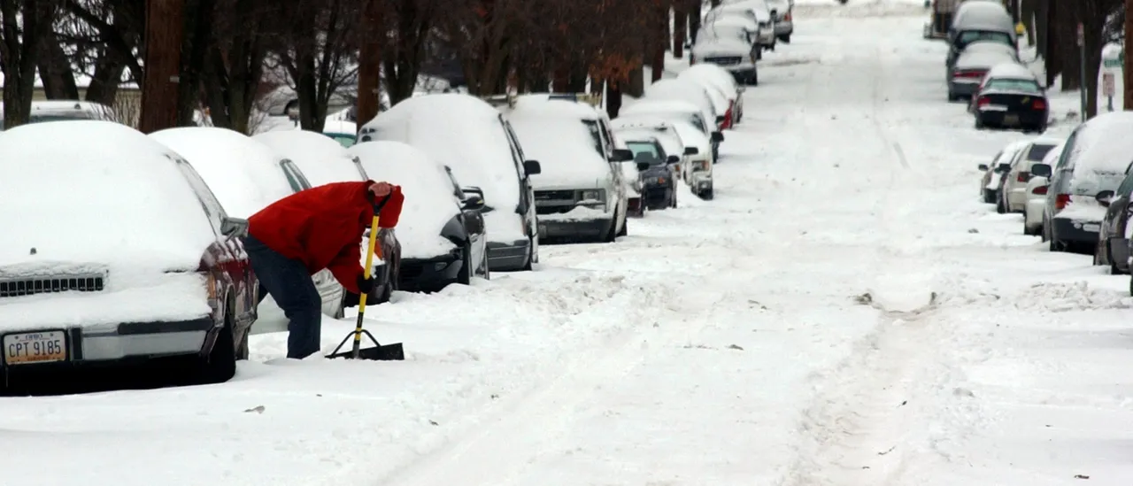
Overnight, a blanket of snow settled into Cincinnati, with a lot of locations picking up about 4 inches.
The system has completely cleared the area, with the heaviest snowfall occurring between 2-5 a.m, according to WLWT.
Some spots picked up as much as 5 inches locally. Meanwhile, Cincinnati/Northern Kentucky International Airport measured 4.3 inches, setting a new snowfall record for Dec. 2.
The snow, which started late Monday night, almost doubled the date’s prior record of 2.2 inches, which had stood since 1929, per WLWT. (RELATED: Northeast Will Be Colder Than Literally Anywhere Else On Earth, Climatologist Warns)
Very cold weather is expected to stick around into next week.
Refreezing is possible Tuesday night as temperatures drop way under freezing. They’re expected to plunge into the teens by the morning, with wind chills dipping to around 10° or lower into the single digits, according to WLWT.
Frosty air is expected through the remainder of this week. Highs will struggle to climb above freezing until the weekend approaches. Then, another system rolls in Sunday, bringing even more snow.
WHAT A VIEW | Drone footage shows Bellevue, the Cincinnati skyline blanketed after a record-breaking first snowfall of the season. 📹: Marcus Browning
How much did your area see? https://t.co/mKrjMtLE0P pic.twitter.com/NPFdB2s2b9
— WLWT (@WLWT) December 2, 2025
In other weather-related news previously reported on by the Daily Caller, a truck driver cheated death in a heart-stopping rescue after his tractor trailer slid off a snow-covered highway in West Virginia, leaving the cab precariously hanging around 100 feet above the ground from the edge of a bridge.
At the scene, a team of first responders sprang into action, quickly shutting down the highway and deploying fire trucks and rescue units for a high-angle operation to pull the driver from the cab.


![Donald Trump Slams Chicago Leaders After Train Attack Leaves Woman Critically Burned [WATCH]](https://www.right2024.com/wp-content/uploads/2025/11/Trump-Torches-Powell-at-Investment-Forum-Presses-Scott-Bessent-to-350x250.jpg)

![Two Dead, 14 Injured After Gunfire Erupts Following College Football Game in Alabama [WATCH]](https://www.right2024.com/wp-content/uploads/2025/10/Two-Dead-14-Injured-After-Gunfire-Erupts-Following-College-Football-350x250.jpg)
![James Carville Admits Democrats Had No Shutdown Endgame, Mishandled Strategy [WATCH]](https://www.right2024.com/wp-content/uploads/2025/11/1763070634_James-Carville-Admits-Democrats-Had-No-Shutdown-Endgame-Mishandled-Strategy-350x250.jpg)