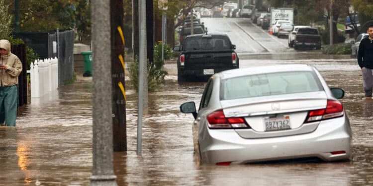
When it comes to November, it’s usually the Pacific Northwest’s wettest month of the season, and like clockwork, multiple atmospheric river-style storms are in the forecast to begin the first full week.
The Pacific Northwest has already been blasted with an atmospheric river storm here in the early month, with Saturday bringing steady rain from a system that was already drenching the region Halloween night to cause a rise in river levels.
Over two inches of rainfall dropped in the mountains, with another inch that was forecasted Saturday. The area previously had Flood Watches that are now canceled, according to FOX Weather. (RELATED: Southeast Could Get Blasted With Coastal Storm To Bring Heavy Rain, Flooding)
Since then, that original November storm has moved out of the Pacific Northwest, but without much of a breather, more atmospheric river-style storms are expected to come through in the month’s first full week courtesy of the Pacific Ocean experiencing an active weather pattern, per the outlet.
By the beginning of the week, a powerful low pressure system will spin in the Bay of Alaska prior to making a gradual shift east towards Canada. Like the previous storm, the area of low pressure will pull moisture north from the Pacific Ocean, guiding it into the Pacific Northwest during late hours Tuesday, per FOX Weather.
🌧️ATMOSPHERIC RIVER: November is typically the wettest month of the season in the Pacific Northwest, and right on schedule multiple atmospheric river-type storms are on the docket to kick off the first full week of the month. More: https://t.co/5kJBhyK2fO pic.twitter.com/EFh4CtlfgJ
— FOX Weather (@foxweather) November 2, 2025
As it rolls into the Pacific Coast, the upcoming atmospheric river is expected to be strong, however, it will be the coast of Oregon that sees the heaviest rainfall this go around. At the time of writing, the Center for Western Water and Weather Extremes are forecasting this storm to be a level 5/5 on their scale for atmospheric rivers, focusing in on parts of Oregon.
By Wednesday, the highest rain amounts are expected to enter Oregon and Washington’s coasts. Those areas are projected to see 3-5 inches of rain between Tuesday-Thursday, while the Olympic Mountains could get 5-8 inches, per the outlet.
It’s anticipated that 1-2 inches of rain will drench areas between southern Oregon and northern California. Flash flooding could also be possible, particularly going into Wednesday afternoon, as the highest rainfall amounts head down the coastline of the Pacific Northwest slowly, per FOX Weather.
Following this system, the region could potentially get hit with another atmospheric river-style storm as forecast models show the possibility for later this week or during next weekend, and with no drier weather pattern in sight for the days ahead, according to the outlet.


![Donald Trump Slams Chicago Leaders After Train Attack Leaves Woman Critically Burned [WATCH]](https://www.right2024.com/wp-content/uploads/2025/11/Trump-Torches-Powell-at-Investment-Forum-Presses-Scott-Bessent-to-350x250.jpg)


