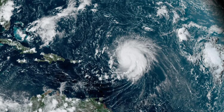
Hurricane Humberto rapidly strengthened into a Category 4 storm late Friday, according to the National Hurricane Center (NHC).
Located around 400 miles from the northern Leeward Islands in the northeast direction, Humberto now has sustained wind speeds of 145 mph.
Tropical Storm Humberto officially became a hurricane Friday morning, declaring itself as the third Atlantic hurricane of the season and eighth named storm overall. (RELATED: State Of Emergencies Issued For Myrtle Beach, South Carolina Ahead Of Potential Hurricane)
Humberto-generated swells will start to impact the northern Leeward Islands, Puerto Rico, Virgin Islands and Bermuda over the weekend, which will cause rip current conditions and surf to be life-threatening, per the NHC.
Over the coming days, Humberto is forecasted to curve towards the west-northwest or northwest, according to the NHC.
The latest track from forecasters has Humberto going out to sea hundreds of miles away from the East Coast of the United States.
Hurricane #Humberto Advisory 10: Humberto Becomes a Powerful Category 4 Hurricane. Rapid Strengthening Should Continue Over the Central Atlantic. https://t.co/tW4KeGdBFb
— National Hurricane Center (@NHC_Atlantic) September 27, 2025
Hurricane Humberto is also being monitored by forecasters regarding whether or not it will have any effects on Potential Tropical Cyclone 9 (PTC9) to its west. According to several computer forecast models, PTC9 will make landfall into the United States’ Southeastern coast.
Multiple state of emergencies have been issued in South Carolina, including in Myrtle Beach, due to Potential Tropical Cyclone 9.
Home to Myrtle Beach, Horry County and South Carolina issued state of emergencies due to a possible hurricane.
As a tropical storm is currently looking to develop, Invest 94L has been redesignated as Potential Tropical Cyclone 9 (PTC9).
Here’s my latest: https://t.co/fd7qT7fwnN pic.twitter.com/edncnAgbHo
— Andrew Powell (@AndrewPow3ll) September 27, 2025
The Atlantic hurricane season ends Nov. 30.


![Scott Bessent Explains The Big Picture Everyone is Missing During the Shutdown [WATCH]](https://www.right2024.com/wp-content/uploads/2025/11/Scott-Bessent-Explains-The-Big-Picture-Everyone-is-Missing-During-350x250.jpg)


