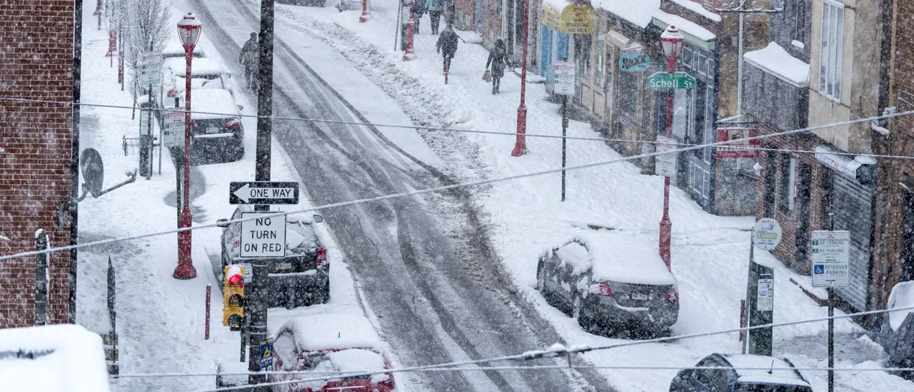
Although many areas along the heavily populated Interstate 95 corridor have recorded below-normal snowfall amounts so far this winter, two distinct weather systems could deliver light snow accumulations from Washington, D.C. northward to Boston through the holiday weekend and into Martin Luther King Jr. Day.
An Arctic cold front is projected to push into the Northeast beginning Saturday, setting the stage for snow showers to develop across multiple key metropolitan areas in the region. (RELATED: Southwestern Michigan Forecast To See Feet Of Lake-Effect Snow, Strong Winds As Winter System Zones In On Great Lakes)
According to the FOX Forecast Center, the heaviest snowfall is expected to target the Poconos in Pennsylvania, extending north into Upstate New York and through New England.
Closer to the I-95 corridor, locations stretching from Washington, D.C. to Philadelphia stand the best chance of seeing the most significant accumulations along the highway itself, which could lead to travel disruptions on one of the nation’s busiest routes.
Round 2 of snow in the parade of storms will develop Friday into Saturday as we get a reinforcing shot of frigid air. Here’s your hour-by-hour forecast. https://t.co/s3dfaggxyi pic.twitter.com/xwy3ac8Acf
— The Weather Channel (@weatherchannel) January 15, 2026
Snowfall may start as early as Friday evening and linger into Saturday morning, with some spots picking up a fast 1-2 inches. The more substantial totals will be limited to higher elevations to the I-95 corridor’s west, where temperatures will remain coldest.
While heavy accumulation is not anticipated everywhere, the greatest likelihood of measurable snow cover exists in interior locations northwest of the major Interstate 95 cities, such as Syracuse, New York.
A few stray flakes could even reach New York City and Boston prior to the system ending later Saturday. (RELATED: Rare Snow Possible In Florida, Georgia As Arctic Cold Sweeps South)
The FOX Forecast Center is also tracking a follow-up opportunity for snow that will arrive shortly after the weekend system.
A low-pressure center is forecast to move rapidly up the Eastern Seaboard late Sunday into Monday morning, bringing the possibility of another light snowfall event along coastal areas.


![Donald Trump Slams Chicago Leaders After Train Attack Leaves Woman Critically Burned [WATCH]](https://www.right2024.com/wp-content/uploads/2025/11/Trump-Torches-Powell-at-Investment-Forum-Presses-Scott-Bessent-to-350x250.jpg)


![Kamala Comes Unglued, Makes Bogus Claim About Her Landslide Loss to Trump [WATCH]](https://www.right2024.com/wp-content/uploads/2025/10/Kamala-Comes-Unglued-Makes-Bogus-Claim-About-Her-Landslide-Loss-350x250.jpg)