Meteorologists with the National Weather Service (NWS) have issued blizzard warnings for multiple states, citing near-zero visibility, heavy snow and high winds that will make travel impossible and could leave motorists stranded as the storm intensifies.
A powerful winter storm is bearing down on the mid-Atlantic, threatening widespread travel chaos, per the NWS. Conditions are expected to make travel impossible in many areas. Officials are urging motorists to remain inside their vehicle for safety in the event they get stranded. (RELATED: Winter Solstice Is Approaching: What To Know About Shortest Day Of Year)
Speaking with Newsweek, NWS lead meteorologist Kevin Rodriguez said that while blizzards are not unusual in the region, they typically arrive later in the winter season.
Multiple blizzard warnings have been issued by the NWS that are in effect from 10 a.m. Wednesday through 10 a.m. Thursday. Affected areas include Grant, Greenbrier, Pendleton, Pocahontas, Preston, Randolph, Tucker and Webster counties in West Virginia, as well as Garrett County in Maryland.
A rare Blizzard Warning has been issued for parts of the apps along the Allegheny Front of Maryland & West Virginia starting tomorrow morning.
Expect Blizzard conditions with snow accumulations between 4 and 8 inches along with winds gusting as high to 40-50 mph. pic.twitter.com/bzw7uauaLy
— StormHQ ☈ (@StormHQwx) December 9, 2025
According to the National Weather Service, blizzard conditions require sustained winds or frequent gusts of 35 mph or higher, combined with falling and blowing snow that drops visibility to a quarter-mile or less for at least three hours.
The current blizzard warnings forecast 3-12 inches of snow across the warned areas, with wind gusts up to 60 mph. Travel is expected to become extremely hazardous as roads, bridges and overpasses could potentially become slick and widespread blowing snow could create whiteout conditions.
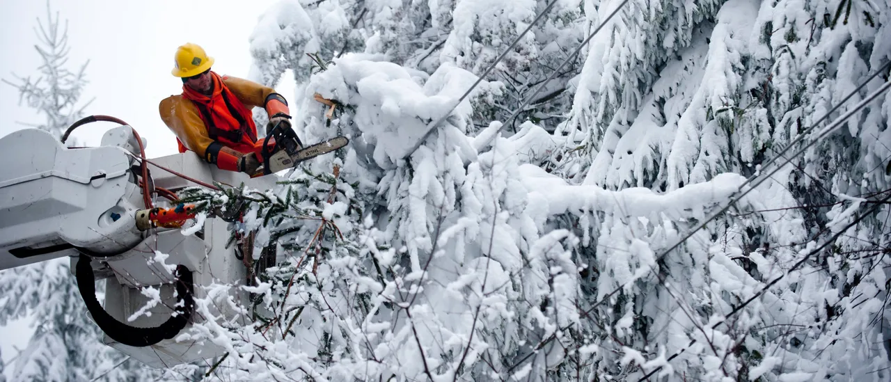
Per the NWS, the worst impacts are expected during Wednesday evening and Thursday morning travel. Power outages are possible as winds could bring down tree limbs and power lines. While some areas may see a brief lull in snowfall Wednesday afternoon, strong winds will continue, keeping visibility low through Thursday morning.
Blizzard warnings remain in effect into Thursday morning across the hardest-hit counties, while winter weather advisories cover an even larger area. After the warnings expire, dangerously icy roads and reduced visibility are likely to linger into Thursday as road crews and utility workers battle to clear highways and restore power.


![Donald Trump Slams Chicago Leaders After Train Attack Leaves Woman Critically Burned [WATCH]](https://www.right2024.com/wp-content/uploads/2025/11/Trump-Torches-Powell-at-Investment-Forum-Presses-Scott-Bessent-to-350x250.jpg)